# The Mystery of the Nazca Lines: Ancient Masterpieces Etched in the Desert
High in the windswept, arid coastal plains of southern Peru lies one of the most mesmerizing archaeological enigmas on Earth. Spanning hundreds of square kilometers across the barren Nazca Desert are thousands of gigantic lines, geometric shapes, and intricate depictions of creatures etched directly into the earth.
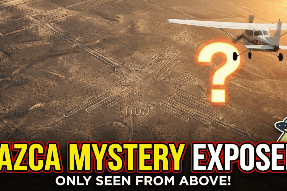
Standing on the desert floor, these markings appear as little more than shallow trenches and faded dirt paths. But when viewed from high in the sky, they transform into breathtaking works of art—so vast and perfectly proportioned that they can only be fully appreciated from the heavens. Created centuries before the invention of flight, the Nazca Lines continue to baffle historians, archaeologists, and travelers worldwide.
—
### Where and When Were They Created?
The Nazca Lines are located on the arid pampas between the towns of Nazca and Palpa, approximately 400 kilometers south of Lima, Peru. The region is one of the driest and most inhospitable environments on the planet, receiving less than an inch of rainfall per year. It is precisely this hyper-arid climate, combined with a lack of ground wind and rare surface erosion, that has preserved these delicate earthworks virtually untouched for thousands of years.
Archaeological research confirms that the geoglyphs were created between 500 BCE and 500 CE, primarily by the Nazca civilization, with earlier origins rooted in the neighboring Paracas culture. During this millennium-long period, generations of ancient craftspeople shaped the desert into a vast open-air canvas.
—
### What Do the Drawings Depict?
The sheer diversity and scale of the Nazca geoglyphs are staggering. Archaeologists have cataloged three distinct categories of etchings:
1. **Straight Lines and Geometric Figures:** Over 800 straight lines, some stretching arrow-straight for up to 20 kilometers without wavering, alongside more than 300 massive geometric polygons, including trapezoids, triangles, spirals, and intersecting rectangles.
2. **Biomorphs (Animals and Plants):** Around 70 magnificent depictions of living creatures, each drawn in a single continuous line. Famous figures include:
– **The Hummingbird:** Spanning 93 meters with an elongated beak.
– **The Spider:** A 46-meter drawing rendered with anatomical precision.
– **The Monkey:** Featuring a distinct, giant coiled spiral tail.
– **The Condor:** A massive bird stretching over 130 meters from wing to wing.
– **The Orca (Whale):** A sea deity representing water and fertility.
– **The Humanoid Figure (“The Astronaut”):** A 32-meter figure etched on a hillside featuring large round eyes and a raised hand.
3. **Plant and Floral Forms:** Stylized representations of trees, flowers, and sacred desert flora.
—
### How Were They Made Without Modern Technology?
For decades, sensationalists argued that ancient humans could not have created such immense designs without aerial guidance. However, modern archaeological discoveries have demonstrated that the construction technique was deceptively simple, requiring brilliant planning and meticulous coordination rather than supernatural assistance.
The desert surface is covered in a layer of dark reddish-brown pebbles coated in iron oxide. The Nazca people simply removed this top layer of dark stones, placing them along the edges to expose the lighter-colored, yellowish-white gypsum-rich subsoil beneath.
To achieve flawless symmetry and scale:
– Ancient surveyors prepared smaller scale models on cloth or pottery.
– They used basic surveying tools—wooden stakes and long ropes made of hemp and cotton—to create proportional grid systems and establish perfectly straight sightlines.
– Wooden stakes discovered at the ends of several lines have been radiocarbon-dated to the Nazca era, confirming this ground-based engineering method.
—
### Why Were They Created? Leading Theories
While science has solved *how* the lines were drawn, the fundamental question of *why* they were created remains the ultimate mystery. Over the past century, several prominent theories have emerged:
#### 1. The Astronomical Calendar Theory
In the 1940s, American historian Paul Kosok and German mathematician Maria Reiche spent decades studying the lines. Reiche—affectionately known as the “Lady of the Lines”—theorized that the geoglyphs served as a giant open-air astronomical observatory and agricultural calendar. She argued that certain straight lines pointed toward solstices and celestial constellations, helping farmers predict seasonal changes and planting cycles.
#### 2. Sacred Ritual Pathways
Modern anthropologists and archaeologists, including Johan Reinhard, believe the geoglyphs were not meant to be viewed as static art from above, but rather walked upon during religious ceremonies. According to this theory, the lines served as sacred processional paths where worshippers and priests walked in ritual processions, chanting and leaving offerings to appeal to the mountain and weather gods for rain.
#### 3. The Water and Agriculture Connection
In the hyper-arid Peruvian desert, water was the ultimate source of life and survival. The Nazca civilization built ingenious spiral-shaped underground aqueducts called *puquios* to tap into subterranean water tables. Many researchers have found that several major line groupings align directly with underground aquifers and dry river valleys, acting as spiritual maps or sacred markers in rainmaking rituals.
#### 4. The Alien Runway Myth
In the late 1960s, author Erich von Däniken popularized the sensational claim that the long straight lines were landing strips for extraterrestrial spacecraft. This theory has been thoroughly dismissed by mainstream scientists. Not only would landing craft sink into the soft sandy subsoil, but the theory also ignores the rich cultural heritage, mathematical ingenuity, and documented religious traditions of the indigenous Nazca people.
—
### An Enduring Wonder of Human Heritage
In 1994, UNESCO designated the Nazca Lines as a World Heritage Site, recognizing them as an exceptional artistic achievement of the pre-Columbian world. In recent years, high-resolution satellite imagery, drone mapping, and AI algorithms have identified over a hundred previously unseen geoglyphs hidden in the surrounding desert hills.
The true magic of the Nazca Lines lies in what they reveal about human ambition. Without engines, flight, or modern instruments, an ancient civilization transformed their harsh desert home into an eternal canvas of devotion, science, and sacred wonder. Over 1,500 years later, these mysterious etchings still gaze upward into the sky, inviting humanity to contemplate the boundless ingenuity of our ancestors.
# नाज़का लाइन्स का रहस्य: पेरू के रेगिस्तान में उकेरी गई प्राचीन विशालकाय आकृतियां
दक्षिणी पेरू के बंजर और पथरीले रेगिस्तान में एक ऐसा पुरातात्विक अजूबा मौजूद है, जिसने सदियों से वैज्ञानिकों, इतिहासकारों और शोधकर्ताओं को हैरान कर रखा है। सैकड़ों वर्ग किलोमीटर में फैले इस रेगिस्तान की ज़मीन पर विशालकाय लकीरें, ज्यामितीय डिज़ाइन और तरह-तरह के जीवों के विशाल चित्र उकेरे गए हैं।
ज़मीन पर खड़े होकर देखने पर ये केवल उथली खाइयों या धूल भरी पगडंडियों जैसी नज़र आती हैं। लेकिन जब इन्हें आसमान से सैकड़ों फीट की ऊंचाई से देखा जाता है, तो ये सांसें थाम देने वाली विशाल और सटीक कलाकृतियों में बदल जाती हैं। हवाई जहाज़ और आधुनिक तकनीक के आविष्कार से हज़ारों साल पहले बनी इन नाज़का लाइन्स (Nazca Lines) का रहस्य आज भी दुनिया को अचंभित करता है।
—
### ये रेखाएं कहाँ और कब बनाई गईं?
नाज़का लाइन्स पेरू की राजधानी लीमा से लगभग 400 किलोमीटर दक्षिण में, नाज़का और पाल्पा शहरों के बीच स्थित रेगिस्तानी पठार पर मौजूद हैं। यह इलाका धरती के सबसे सूखे और कठोर वातावरण वाले क्षेत्रों में गिना जाता है, जहाँ साल भर में नाममात्र की बारिश होती है। यहाँ तेज़ हवाओं और ज़मीनी कटाव की अनुपस्थिति ने ही इन नाज़ुक आकृतियों को पिछले दो हज़ार सालों से बिल्कुल सुरक्षित और अक्षुण्ण बनाए रखा है।
पुरातात्विक अनुसंधानों के अनुसार, इन विशाल भू-आकृतियों (Geoglyphs) का निर्माण 500 ईसा पूर्व से 500 ईस्वी के बीच नाज़का सभ्यता के लोगों द्वारा किया गया था, जिसकी शुरुआती नींव पराकास (Paracas) संस्कृति में मिलती है। सदियों के इस दौर में प्राचीन कारीगरों की पीढ़ियों ने इस बंजर मरुस्थल को एक विशाल खुली कला दीर्घा में तब्दील कर दिया।
—
### इन रेखाओं में क्या-क्या बना है?
नाज़का के रेगिस्तान में बनी आकृतियों का पैमाना और उनकी विविधता हैरान कर देने वाली है। पुरातत्वविदों ने इन्हें तीन प्रमुख श्रेणियों में बांटा है:
1. **सीधी रेखाएं और ज्यामितीय आकृतियां:** यहाँ 800 से अधिक सीधी रेखाएं हैं, जिनमें से कई बिना मुड़े 20 किलोमीटर तक एकदम सीधी जाती हैं। इसके अलावा 300 से अधिक विशाल ज्यामितीय डिज़ाइन मौजूद हैं, जिनमें समलंब (Trapezoids), त्रिभुज, सर्पिल (Spirals) और आयत शामिल हैं।
2. **जीव-जंतुओं और पक्षियों की आकृतियां (Biomorphs):** यहाँ करीब 70 जीवों के अत्यंत सटीक और सुंदर चित्र हैं, जिन्हें एक ही निरंतर रेखा द्वारा बनाया गया है। इनमें प्रमुख हैं:
– **हमिंगबर्ड (Hummingbird):** 93 मीटर लंबी विशाल चिड़िया जिसकी चोंच बेहद नुकीली और लंबी है।
– **मकड़ी (Spider):** 46 मीटर चौड़ी मकड़ी, जिसे शारीरिक रूप से बेहद सटीक अनुपात में बनाया गया है।
– **बंदर (Monkey):** घुमावदार गोल पूंछ वाला एक विशाल बंदर।
– **कोंडोर (Condor):** 130 मीटर से अधिक पंखों के फैलाव वाला एक विशाल पक्षी।
– **व्हेल (Orca):** पानी और उर्वरता का प्रतीक माना जाने वाला समुद्री जीव।
– **मानवाकार आकृति (“द एस्ट्रोनॉट”):** पहाड़ी की ढलान पर बनी 32 मीटर की आकृति, जिसके गोल चेहरे पर बड़ी आंखें और उठा हुआ हाथ दिखाई देता है।
3. **पेड़-पौधे और वनस्पतियां:** रेगिस्तानी वनस्पतियों, फूलों और पेड़ों के कलात्मक चित्र।
—
### बिना आधुनिक औज़ारों के ये आकृतियां कैसे बनीं?
शुरुआती दौर में कई लोगों का मानना था कि ज़मीन से देखे बिना इतनी विशाल आकृतियां बनाना प्राचीन इंसानों के लिए असंभव था। लेकिन पुरातात्विक खोजों ने यह साबित कर दिया कि इसके निर्माण की तकनीक दिखने में बेहद सरल लेकिन योजना और गणित में असाधारण थी।
नाज़का रेगिस्तान की ज़मीन आयरन ऑक्साइड युक्त गहरे लाल-भूरे रंग के पत्थरों और कंकड़ों से ढकी है। नाज़का के लोगों ने बस इस ऊपरी गहरी परत के पत्थरों को हटाकर किनारे कर दिया, जिससे नीचे मौजूद हल्के पीले-सफेद रंग की चूनेदार मिट्टी उजागर हो गई।
परफेक्ट अनुपात और सममिति हासिल करने के लिए:
– प्राचीन शिल्पकारों ने पहले कपड़ों या मिट्टी के बर्तनों पर छोटे पैमाने के मॉडल तैयार किए।
– इसके बाद लकड़ी की खूंटियों और सन/कपास की लंबी रस्सियों की मदद से ज़मीन पर ग्रिड प्रणाली बनाकर अनुपातिक विस्तार किया गया।
– रेखाओं के सिरों पर मिली लकड़ी की खूंटियों की रेडियोकार्बन डेटिंग ने पुष्टि की है कि यह पूरी तरह से इंसानी बुद्धिमत्ता और श्रम का परिणाम था।
—
### इनके निर्माण का वास्तविक उद्देश्य क्या था?
विज्ञान ने यह तो सुलझा लिया कि ये रेखाएं *कैसे* बनीं, लेकिन सबसे बड़ा रहस्य यह है कि इन्हें *क्यों* बनाया गया? इतिहास और विज्ञान में इसके कई प्रमुख सिद्धांत मौजूद हैं:
#### 1. खगोलीय वेधशाला और सौर कैलेंडर
1940 के दशक में अमेरिकी इतिहासकार पॉल कोसोक और जर्मन गणितज्ञ मारिया राइश ने अपने जीवन के 50 साल इन रेखाओं के अध्ययन में समर्पित कर दिए। मारिया राइश, जिन्हें “लेडी ऑफ द लाइन्स” कहा जाता है, का मानना था कि यह पूरा क्षेत्र एक विशाल खगोलीय कैलेंडर था। कई सीधी रेखाएं अयनांत (Solstices) और नक्षत्रों की दिशा से मेल खाती हैं, जिससे फसलों की बुवाई और कटाई के चक्र को समझा जाता था।
#### 2. धार्मिक अनुष्ठान और पवित्र मार्ग
आधुनिक पुरातत्वविद जोहान रेनहार्ड का मानना है कि इन आकृतियों को ऊपर से देखने के लिए नहीं, बल्कि धार्मिक अनुष्ठानों के दौरान उन पर चलने के लिए बनाया गया था। लोग और पुजारी इन एकल रेखाओं वाले मार्गों पर चलते हुए प्रार्थना करते थे और वर्षा तथा मौसम के देवताओं को प्रसन्न करने के लिए भेंट चढ़ाते थे।
#### 3. भूमिगत जल और जीवन का संबंध
अत्यधिक सूखे रेगिस्तान में जीवन की सबसे बड़ी आवश्यकता पानी थी। नाज़का सभ्यता ने ज़मीन के नीचे पानी तक पहुँचने के लिए सर्पिलाकार भूमिगत नहरें (Puquios) बनाई थीं। कई शोधकर्ताओं के अनुसार, ये रेखाएं भूमिगत जल स्रोतों और सूखी नदी घाटियों की ओर इशारा करती हैं, जो जल अनुष्ठानों और सिंचाई के पवित्र नक्शे का काम करती थीं।
#### 4. एलियन थ्योरी और उसका खंडन
1960 के दशक में लेखक एरिच वॉन डैनिकेन ने दावा किया था कि ये लंबी सीधी रेखाएं एलियन अंतरिक्ष यानों के लिए हवाई पट्टियां (Runways) थीं। हालांकि, आधुनिक वैज्ञानिकों ने इस सिद्धांत को सिरे से खारिज कर दिया है, क्योंकि रेगिस्तान की रेतीली ज़मीन पर कोई भी भारी यान धंस जाएगा। इसके अलावा, यह परिकल्पना प्राचीन स्थानीय लोगों की समृद्ध कला और इंजीनियरिंग प्रतिभा को नज़रअंदाज़ करती है।
—
### प्राचीन मानव सभ्यता की एक अमर धरोहर
1994 में यूनेस्को (UNESCO) ने नाज़का लाइन्स को विश्व धरोहर स्थल घोषित किया। हाल के वर्षों में उपग्रह चित्रों, ड्रोन्स और एआई (AI) तकनीकों की मदद से पहाड़ी ढलानों पर सौ से अधिक नई आकृतियों की खोज की गई है।
नाज़का लाइन्स इस बात का जीवंत प्रमाण हैं कि आधुनिक मशीनों और तकनीक के बिना भी प्राचीन मानव ने अपनी आस्था, विज्ञान और अदम्य इच्छाशक्ति से रेगिस्तान के सीने पर ऐसा इतिहास लिख दिया जो आज भी आसमान की ओर ताकते हुए इंसानी प्रतिभा की दास्तान सुनाता है।
# Nazca Lines Ka Rahasya: Peru Ke Desert Mein Bani Vishal Aakritiyan
Southern Peru ke sookhe aur pathreele desert mein ek aisa ancient chamatkar chhipa hua hai, jisne saalon se duniya bhar ke scientists, historians aur travelers ko hairan kar rakha hai. Nazca Desert ke saikdon square kilometers ke ilaqe mein zameen par aisi vishal lakeerein aur aakritiyan bani hui hain, jinhe zameen par khade hokar poora dekh pana lagbhag namumkin hai.
Zameen par khade hokar dekhne par ye sirf choti-moti naaliyan ya pashuon ke chalne wale raaste lagti hain. Lekin jaise hi aap aasman mein flying plane ya drone se neeche dekhte hain, ye dhool bhari lines badal kar hairatangez drawings ban jaati hain—itni vishal aur perfect proportion mein ki lagta hai jaise kisi ne desert ko ek open canvas bana diya ho. Hawaai jahaz ke aavishkar se sadiyon pehle bani ye Nazca Lines aaj bhi dunya ki sabse ajeeb mysteries mein gini jaati hain.
—
### Kahan Aur Kab Banayi Gayi Thi Ye Lines?
Nazca Lines Peru ki capital Lima se kareeb 400 kilometer south mein, Nazca aur Palpa sheharon ke beech pampas (desert plains) par maujood hain. Ye jagah poori duniya ke sabse dry aur banjar ilaqon mein se ek hai, jahan saal bhar mein shayad hi kabhi baarish hoti ho. Yahan na tez hawayen chalti hain aur na hi zameen ka kataav hota hai—aur yahi wajah hai ki ye naazuk lakeerein pichhle do hazar saalon se bina mitti me dabe surakshit bachi rahi hain.
Archaeological discoveries se pata chalta hai ki in geoglyphs ko 500 BC se 500 AD ke dauran Nazca civilization ke logon ne banaya tha, jinki shuruat unse pehle aayi Paracas culture se hui thi. Lagbhag ek hazar saal ke is dauran, peedhi-dar-peedhi kalakaron ne is registan ko apni aasthao aur gyaan se sajaya.
—
### Desert Par Kya-Kya Bana Hua Hai?
Nazca ke registan mein bani aakritiyon ka scale aur diversity dimaag hila dene wali hai. Researchers ne inhe teen major categories mein baanta hai:
1. **Seedhi Lines Aur Geometric Patterns:** 800 se zyada bilkul seedhi lines, jinme se kuch 20 kilometer tak bina kisi mod ke laser jaisi seedhi jaati hain. Iske alawa 300 se zyada vishal geometric shapes hain, jaise trapezoids, triangles, spirals aur rectangles.
2. **Jeev-Jantu Aur Parinde (Biomorphs):** Kareeb 70 alag-alag animals aur birds ke accurate drawings, jinhe ek hi continuous single line se banaya gaya hai. Kuch famous figures hain:
– **Hummingbird:** 93 meter lambi chidiya jiski choonch lambi aur teekhi hai.
– **Spider:** 46 meter ki spider jiske joints aur structure anatomical precision dikhate hain.
– **Monkey:** Ek vishal bandar jiski poonch gol spiral mein ghoomi hui hai.
– **Condor:** 130 meter se bada vishal parinda jiske pankh phaile hue hain.
– **Whale (Orca):** Samundri jeev jo paani aur fertility ka prateek tha.
– **The Astronaut:** Pahadi ki dhalan par bani 32 meter ki aakriti, jiska chehra gol aur aankhen badi hain aur haath hawa mein utha hua hai.
3. **Plants Aur Tree Figures:** Desert ke sacred pedon aur phoolon ke stylized designs.
—
### Bina Modern Tools Ke Ye Kaise Banayi Gayi?
Ek lambe arse tak logon ko lagta tha ki bina aasman mein ude aisi vishal aakritiyan banana humanly impossible hai. Lekin archaeological research ne dikhaya ki iska construction technique bohot simple tha, par iske piche ka planning aur mathematical mind extraordinary tha.
Nazca Desert ki zameen iron-oxide se daki hui gehri laal-bhoori kankad-pattharon se bhari hai. Nazca ke logon ne bas is dark layer ke patharon ko hata kar kinaron par rakh diya, jisse neeche ki halki peeli-safed chalky mitti saamne aa gayi. Contrast ki wajah se ye lines saaf dikhne lagi.
Symmetry aur scale maintain karne ke liye:
– Kalakaron ne pehle chote scale ke models kapde ya mitti ke bartano par banaye.
– Uske baad lakdi ki khoontiyon aur lambi rassiyon (cotton/hemp cords) ki madad se zameen par grid system banakar exact proportions draw kiye.
– Lines ke kinaron par mili lakdi ki khoontiyon ki radiocarbon dating ne confirm kiya ki ye ancient surveying techniques ka hi kamaal tha.
—
### Aakhir Inhe Banane Ka Purpose Kya Tha?
Ye toh samajh aa gaya ki lines *kaise* bani, par sabse bada sawal ye hai ki inhe *kyun* banaya gaya? Is mystery ko lekar experts ne kai powerful theories di hain:
#### 1. Astronomical Calendar Theory
1940s mein American historian Paul Kosok aur German mathematician Maria Reiche ne apni poori zindagi in lines ki study mein laga di. Maria Reiche—jinhe “Lady of the Lines” kaha jata hai—ka manna tha ki ye registan ek vishal astronomical calendar tha. Unke mutabiq ye lines solstices, constellations aur celestial events ki disha mein aligned thi, jisse fasal bone aur kaatne ka waqt pata chalta tha.
#### 2. Sacred Ritual Pathways
Modern archaeologists jaise Johan Reinhard ka manna hai ki ye drawings aasman se dekhne ke liye nahi, balki un par chalkar prayer karne ke liye banayi gayi thi. Log in single continuous lines par processional walk karte the aur mausam aur baarish ke devtaon ko khush karne ke liye offerings chadhate the.
#### 3. Paani Aur Underground Aquifers Ka Connection
Is extreme dry desert mein paani hi zindagi ka sabse bada sahara tha. Nazca civilization ne underground water tables tak pahunchne ke liye *puquios* (spiral wells) banaye the. Kai studies batati hain ki major lines underground aquifers aur sookhi nadiyon ke raaste ki taraf point karti hain, jo rainmaking rituals ke sacred maps the.
#### 4. Alien Runway Ka Myth
1960s mein writer Erich von Däniken ne ek sensational claim kiya tha ki ye lines alien spaceships ke liye landing runways thi. Lekin mainstream science ne ise poori tarah reject kar diya. Desert ki naram mitti par koi bhi spaceship dhas jaati, aur ye theory indigenous logon ke gyaan aur engineering capability ko nazarandaz karti hai.
—
### Ek Amar Virasat Aur Ankahe Sawal
1994 mein UNESCO ne Nazca Lines ko World Heritage Site declare kiya. Haal ke saalon mein drones, satellite images aur AI algorithms ki madad se registan ke pahadi ilaqon mein sau se zyada nayi drawings khoji gayi hain.
Nazca Lines is baat ka saboot hain ki bina modern technology ke bhi ancient human civilization ne apni devotion, science aur creativity ke dum par registan ki chhati par ek aisa itihaas likh diya jo aaj bhi aasman ki taraf dekhte hue hume unki adbhut taakat ka ehsaas karata hai.